OCDB data flow diagram
Ocean colour related insitu measurements are collected within the Ocean Colour database OCDB. Investigators can upload their data as text files in the SEABASS file format to make them publically available for download to other users.
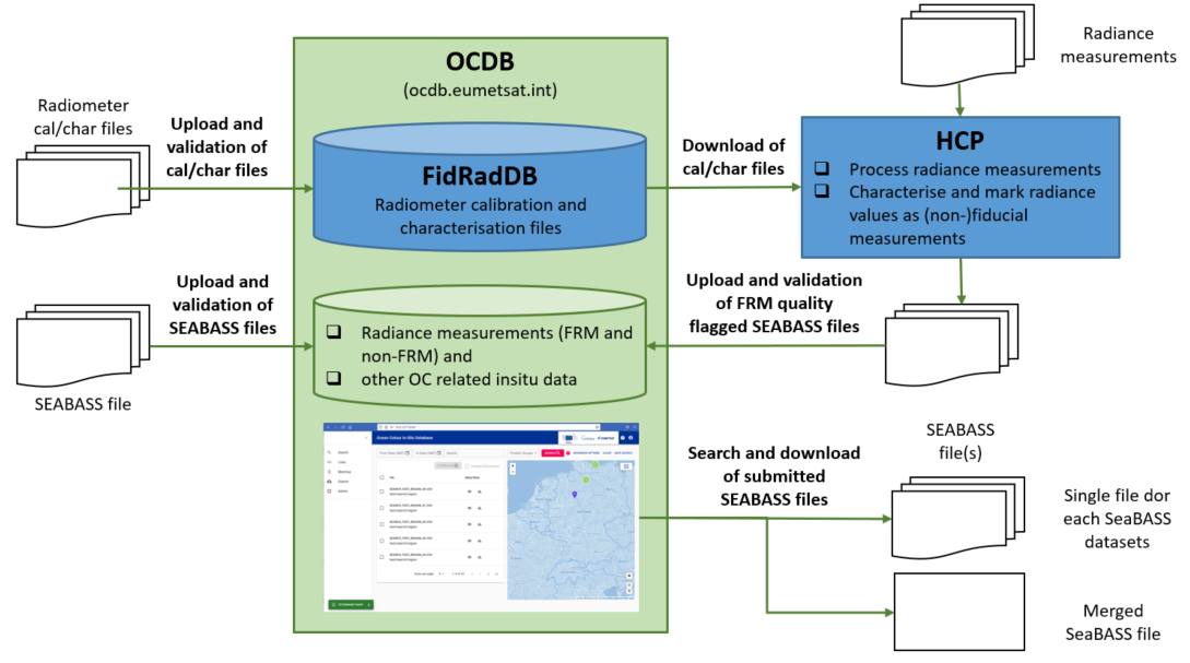
Fig. 1: Data flow diagram of the OCDB database.
If uploaded data are compatible to SEABASS, they are categorised as validated automatically. Afterwards, an ODBC admininstrator can process the data files in the database and finally make them publically available. Not valid data sources can be categorised as accepted by an administrator to make the data files available for EUMETSAT-internal use.
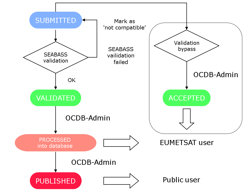
Fig. 2: OCDB validation proces as flow diagram.
Data from external datasources such as AERONET-OC, MOBY buoy data and biogeochemical ARGO (BGC ARGO) shall be ingested into the OCDB. Data shall be accessible by EUMETSAT users only and will not provided for download by the OCDB web user interface to avoid redundancy in the WWW.